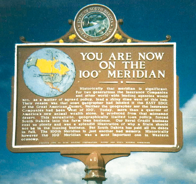

In 1879, John Wesley Powell established a line of longitude in the United States representing the boundary between the moist east and the arid west. The 100th meridian wasn’t selected just because it was a nice round number. It actually was one of the strongest natural boundaries in the world, marking the switch between the non-irrigated east and the irrigation-necessary west.
Thanks to global-scale wind patterns, to the west of the 100th meridian, rainfall drops sharply, and to the east of the line it picks up sharply. Powell described what he saw in 1890, writing, ““Passing from east to west across this belt a wonderful transformation is observed. On the east a luxuriant growth of grass is seen, and the gaudy flowers of the order Compositae make the prairie landscape beautiful. Passing westward, species after species of luxuriant grass and brilliant flowering plants disappear; the ground gradually becomes naked, with bunch grasses here and there; now and then a thorny cactus is seen, and the yucca plant thrusts out its sharp bayonets.”
The effect of this line is still easy to see, says Kevin Krajick, senior editor for science at the Earth Institute. “To the west, population density drops sharply. There are fewer homes, commercial facilities and roads. Farms are fewer, but bigger, reflecting the economics of less water and thus lower productivity. To the east, 70 percent of the crop is moisture-loving corn; to the west, aridity-resistant wheat is dominant.”

After determining that such a line really does exist, researchers from Penn State, Columbia Engineering, and the Lamont-Doherty Earth Observatory took a closer look at it. What they found is that the line has shifted from the 100th meridian to the 98th, about 140 miles to the east. Rainfall hasn’t changed much in the northern plains, but temperatures there are going up, increasing evaporation from the soil. Wind patterns have also changed, causing less rain to fall.
Land use hasn’t yet been affected because the changes are still very small and gradual. But Richard Seager of the Earth Observatory theorizes that as drying progresses, farms in the east may have to consolidate, irrigate, or change the crops they raise. He even sees the possibility that cropland will be converted back to pasture and western-style grazing.


During the debate over how much land to give in homesteads in the area west of the 100th, Congress had Powell survey the situation and report back. Powell’s reply was four sections. In the east where 40 to 80 acres was enough to make a living and between not understanding the climate difference and politics, 160 acres was deemed enough.
Comments are closed.